6 DAYS TREKKING
in El hierro
Program
- Self-guided hiking tour in El Hierro
- 6 days of hiking
- Luggage and/or passenger transport
- Transfers to/from the airport/port to the hotel
- Daily choice between an intermediate or high-level hiking route
El Hierro, the westernmost, southernmost, least populated, and smallest of the Canary Islands, exudes a unique end-of-the-world atmosphere. Recognized as a biosphere reserve and geopark by UNESCO, this island has carefully preserved its natural and cultural heritage. To fully appreciate its treasures, it is recommended to explore it on foot along its trails. This program has been designed for you to discover both the island’s interior and its coast. The interior is characterized by landscapes shaped by recent volcanic activity, lush forests, and rural areas of great serenity. The rugged and wild coast has been molded by volcanic eruptions, giving rise to astonishing landscapes: sheltered natural pools, basaltic formations, rocky arches, islets… The North Coast, where the ocean waters are usually turbulent, is truly impressive, while the South typically reveals a tranquil calmness. Its crystal-clear waters are renowned as the best spot for diving and snorkeling in the Canary Islands. Botany enthusiasts will be delighted by the island’s plant variety, which harbors numerous endemic species and majestic trees like the twisted junipers, sculpted by the wind, or the legendary “Garoé,” a sacred tree of the ancient inhabitants, the Bimbaches, not to mention the centuries-old pine trees and giant moss-covered heathers. Despite its modest size of only 270 km2, El Hierro is brimming with botanical, geological, and cultural richness that surprises with its uniqueness. This atypical and wild island leaves no one indifferent.
Day 1: Valverde – Mirador de La Peña
One of the most fascinating hikes on the island, harmoniously combining nature and culture.
The hike starts from your hotel towards the Mirador de La Peña. After leaving behind Valverde, the island’s capital, you will cross the preserved landscape of Ventejís, with gentle reliefs. After a few hours of hiking, you will arrive at the interpretation center of the Garoé Tree. This tree (the original was knocked down by a storm in the 17th century) was the main source of water for the ancient inhabitants of the island, the “Bimbaches,” in times of rainfall scarcity. This is one of the most famous myths of the island and the Canary Islands. The great navigators of the 15th and 16th centuries, such as Magellan, who made a stop in El Hierro, never failed to describe this legendary tree in their navigation journals.
Then, the forest gradually gives way to agricultural landscapes. Fields bordered by stone walls, the frequent fog in the region, sheep, cows… create an atmosphere that instantly evokes Ireland.
On this occasion, we recommend stopping for lunch at a local restaurant known as one of the best on the island.
In the second part of your journey towards the Mirador de La Peña, you will discover a creation by the eminent Canary Island artist, César Manrique. This place perfectly embodies Manrique’s genius: the exceptional choice of the site offering one of the most beautiful island views on the cliff edge, the seamless integration of the Mirador buildings and the restaurant into the landscape, and a garden adorned with emblematic endemic plants of the island and the archipelago.
Entrance fee for the El Garoé visitor center: €2.5 (for non-residents)
Medium level: Distance: 12km / Hiking time: 4:00 / Ascent-descent: +440m, -500m
High level: Distance: 16km / Hiking time: 5:30 / Ascent-descent: +600m, -550m
Day 2: Ermita de Los Reyes – « El Sabinar »
Absolutely exceptional hike! The guide’s favorite!
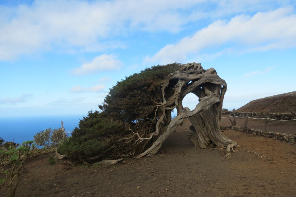
For this second hike, you will discover one of the mythical areas of El Hierro. You will visit historical sites like the sanctuary of the Virgin of Los Reyes (patron saint of the island). Every 4 years, a grand procession is organized to transfer her to the main church of Valverde. From there, you will head towards “El Sabinar,” known for its majestic juniper, the vegetal symbol of the island. Then, you will be directed towards the viewpoint of “Los Bascos,” where the view over El Golfo will leave you breathless.
Passing by the spectacular emblematic juniper of El Hierro and the magnificent Los Bascos viewpoint, you will traverse various levels of vegetation: first walking along a trail that will lead you through arid vegetation that quickly transforms into more humid and lush vegetation, the famous Laurisilva. This is a primary forest primarily composed of laurels and tree heathers. The viewpoints during the descent towards Sabinosa will also leave you speechless.
In short, an experience not to be missed!
Medium level: Distance: 10km / Hiking time: 4:30 / Ascent-descent: +300m, -970m
High level: Distance: 17km / Hiking time: 8:00 / Ascent-descent: +1150m, -1150m
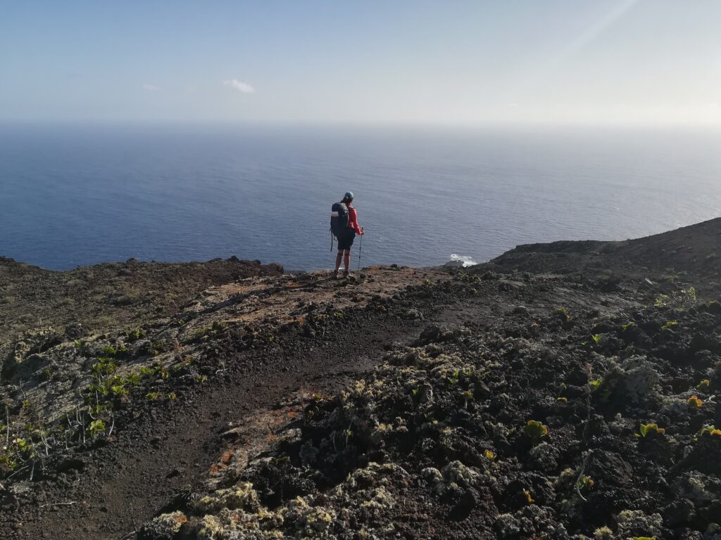
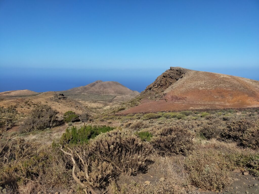
Day 3: Sabinosa – Malpaso (summit of the island) -El Pinar
Great north to south journey across El Hierro passing through the island’s summit!
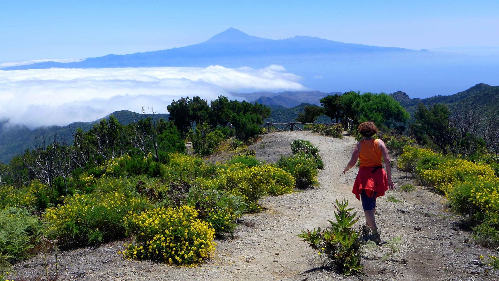
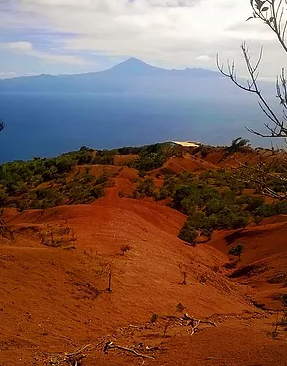
This rather demanding hike is absolutely splendid! Starting from Sabinosa, you begin the ascent towards Malpaso, the highest point on the island (1501 meters). This traditional trail was once the communication route connecting the north and south of the island. The first part up to the central plateau is the most challenging (high level). However, the effort is worth it: the views during the ascent are breathtaking, and the changes in vegetation are surprising. You will pass through areas of vineyards, orchards, thermophilic forests (more open and incredibly colourful in spring), and finally through the lush Laurisilva. The landscapes are magnificent, offering views of El Golfo and the village of Sabinosa. Initially, you will traverse landscapes of recent volcanism, marked by volcanic cones and lapillis. Subsequently, you will enter the lush laurisilva of the Mencáfete nature reserve, a subtropical forest, a relic of the forests that once covered North Africa and Europe in the Tertiary era. As you approach the summit, vegetation becomes scarcer. From this point, the 360-degree panoramic view over El Hierro and the surrounding islands like La Gomera, Tenerife (appearing as one), and La Palma, is impressive. After reaching the highest point of the hike, you will descend towards the southern side through majestic pine forests composed of the endemic Canary Island pine (Pinus canariensis) to the charming village of El Pinar.
The medium level starts in La Llanía, known for its magnificent Laurisilva.
Medium level: Distance: 12km / Hiking time: 4:00 / Ascent-Descent: +110m, -600m
High level: Distance: 17km / Hiking time: 7:30 / Ascent-Descent: +1250m, -700m
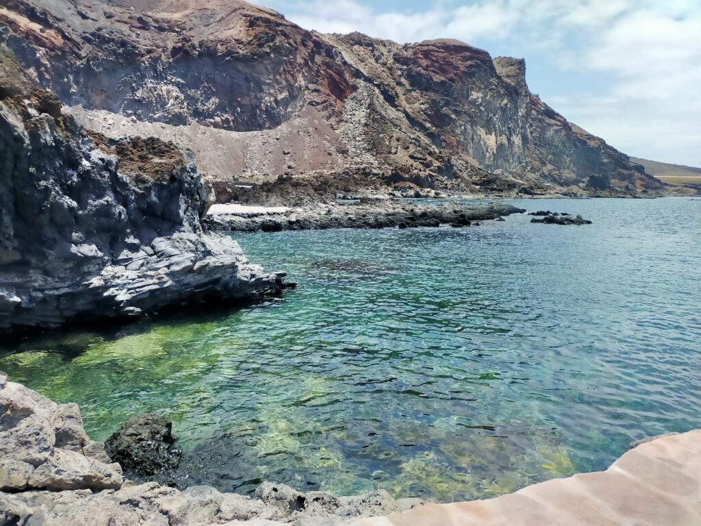
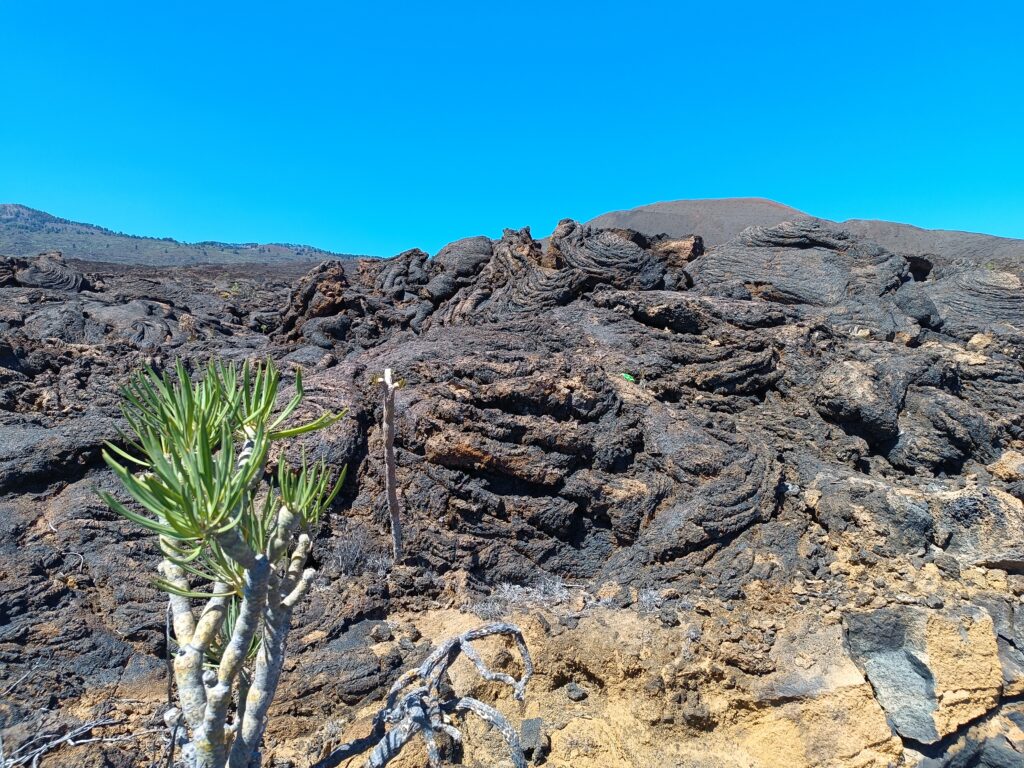
Day 4: El Pinar – Tacorón
Tacorón Cove, a paradise for sea lovers.
The descent from El Pinar through the volcanoes and lava fields leads to the charming Tacorón Cove, an ideal place for swimming and snorkeling at the end of the hike (or halfway depending on the chosen level). After exploring the north side of the island, you will discover the south side, shielded from the trade winds. Therefore, this slope is sunnier and “rockier” than the other side, while offering the calmest sea on the island known as the “sea of calm.” This wonderful marine expanse constitutes a marine reserve renowned for snorkeling and scuba diving. Currently in the process of becoming a national park, this nature reserve will be Spain’s first entirely underwater national park.
After a swim, you can choose to return by taxi or on foot.
Medium level: Distance: 12km / Hiking time: 3:00 / Descent: -810m
High level: Distance: 19km / Hiking time: 7:00 / Ascent-descent:: +850m, -850m
Day 5: El Pinar – Timirijaque
Discovery of the eastern area of El Hierro.
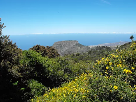
From the heights, you overlook the depression of “Las Playas,” a spectacular geomorphological gem formed by a colossal gravitational landslide (similar phenomenon to that of El Golfo). Classified as a “natural monument,” this protected natural space is distinguished by its steep slopes and deeply carved ravines. The diversity of its mineral composition offers a palette of colours ranging from yellow to black, creating a landscape that is both striking and unique. The views from “Las Playas” and “Isora” during the first part of the hike are impressive. Botany enthusiasts will find their happiness here, as the region is home to remarkable endemic species such as the Canarian Spurge, the Blue Echium of El Hierro, and, of course, the Canarian Pine. Some of these pines seem to defy gravity by clinging to cliffs at over a thousand meters altitude like tightrope walkers.
Descending, you pass through picturesque villages with traditional architecture, characterized by stone houses with unique roofs designed to collect rainwater and supply water to each home, an ingenious system in response to the scarcity of water sources on the island.
The descent to the sea is done over 900 meters of gentle slope, without vertigo. You will then explore another natural space, the preserved landscape of “Timijarque,” whose name of Bimbache origin (prehispanic people) evokes a “rocky terrain with dark tones.” A description that faithfully reflects the panorama you will discover. The bay of Timirijaque, the endpoint of the hike, hosts some houses, two restaurants, and a black sand beach (note that the sea can often be rough). This place is ideal for regaining strength before taking a taxi back to your hotel.
Medium level: Distance: 9km / Hiking time: 4:00 / Ascent-descent: +110m and -900m
High level: Distance: 17km / Hiking time: 6:00 / Ascent-descent: +350m, -1200m
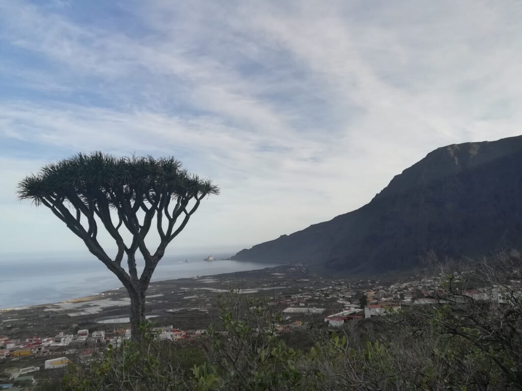
Day 6: Valverde – Tamaduste
From Valverde to its recreation area: Tamaduste.
Two different routes for the same destination: the magnificent cove of Tamaduste!
The demanding route passes through Echedo, a charming rural village where vineyards, potatoes, and figs predominate. The trail that connects Echedo with Tamaduste is spectacular but is recommended for individuals without vertigo.
The medium-level route, faster and without dizzying sections, is more direct.
Tamaduste, a small coastal village, is located at the foot of a basaltic cliff amphitheatre. The houses cluster around a large natural pool. This pool was formed by a lava flow. The way the lava cooled created a bathing area sheltered from the waves. The residents of Valverde often come here to swim with pleasure.
Once you arrive in Tamaduste, you can decide whether to stop there or keep walking. It all depends on whether you want to enjoy the crystal-clear waters of this cove to relax before returning or if you prefer to make the most of the beautiful trails of El Hierro. In this case, you can continue walking along the lovely coastal trail that starts in Tamaduste. This trail crosses a spectacular lava flow. Along this path, you can see basaltic formations, coves, arches… It is also a privileged spot for observing seabirds.
A taxi will come to pick you up and take you to the airport, the port, or your hotel.
Medium level: Distance: 9km / Hiking time: 3:30 / Ascent-descent: +130m and -700m
High level: Distance: 15km / Hiking time: 5:00 / Ascent-descent: +200m, -770m


Selfguided option
Prices
Number of people….. Price per person
2 people ……………………………… €275/p
3 people ……………………………… €220/p
4 people ……………………………… €170/p
5 people ……………………………… €159/p
6 people ……………………………… €150/p
Included:
– Luggage transfer from day 1 to day 6
– Transportation required for your tour
– Phone contact of the local guide during your entire hike
– Application with self-guided hikes
Not included:
– hotels
– food
For hotels, you will be provided with a list of places to stay overnight so that you can make the reservation yourself. However, if you prefer, we can also take care of booking the hotels for you.
Our advantages:
1. Trekking itinerant
2. Application with self-guided hikes
3. Contact with a guide if needed during your stay
4. Flexible itinerary: each day, you can choose between a moderate (N2) or sustained (N3) level for your walk
5. Luggage and people transfer included for all days of walking
6. port or airport transport included
2 possible levels for your daily route :
N2 = Moderate : between 3 and 5 hours, gradiant+ : 600m max
N3 = High between 4 and 8 hours, gradiant+ : >600m
Contact me

Turism register: Intermediador turistico I-0004482.1 Turismo Activo TA-6-0006344.36
Photography